
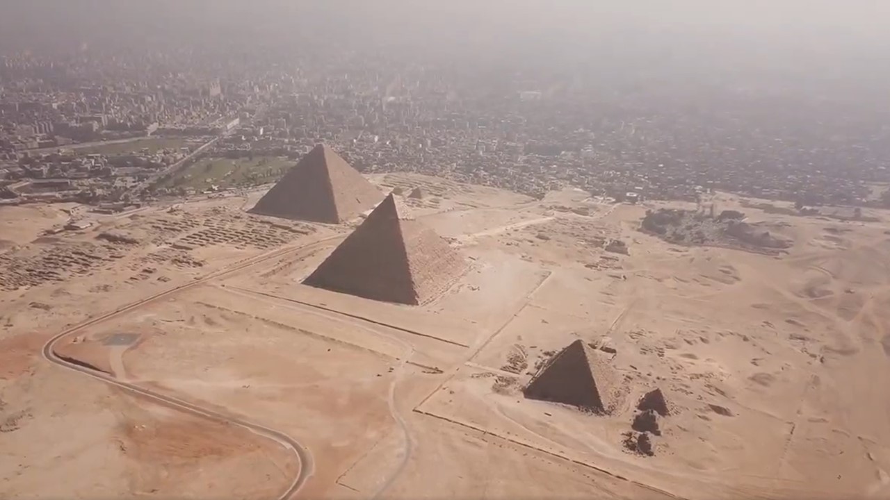
A new frontier in archaeological science has opened high above the sands of Egypt. Using advanced radar imaging from orbit, the team of researchers led by Filippo Biondi and Corrado Malanga has mapped the internal architecture of the Great Pyramid of Giza — one of humanity’s oldest and most studied monuments — with extraordinary detail. This non-invasive method may redefine how we study ancient structures without disturbing a single stone.
It is worth noting, however, that the research remains in the form of a pre-print and has not undergone peer review. More than three years have passed since its initial public release in 2022, prompting questions from some scholars about the methodology, reproducibility, and the interpretation of results.
The Promise of Space-Based Imaging
The study centers around a novel use of Synthetic Aperture Radar (SAR) Doppler tomography. SAR has long been used for Earth observation, particularly for detecting land deformation or structural movement. However, its application in penetrating ancient stonework represents a significant shift.
Traditional SAR is limited by the inability of electromagnetic waves to deeply penetrate dense, solid structures like granite and limestone. However, by focusing not on static imagery but on subtle micro-movements — tiny vibrations naturally occurring in the structure due to environmental factors — the researchers turned a limitation into an opportunity.
The technique measures how these vibrations, influenced by distant seismic activity, wind, and urban motion, subtly shift the radar signal. Through precise analysis of these Doppler shifts, the team reconstructed internal images of the pyramid at nearly one-meter resolution.
Reconstructing the Pyramid from Within
The researchers began by validating the technique against known features: the King’s Chamber, the Queen’s Chamber, the Grand Gallery, and the so-called “unfinished” subterranean chamber. These well-documented structures appeared clearly in the radar data, affirming the method’s initial accuracy.
Once validated, the imaging revealed numerous other anomalies — corridors, cavities, and chambers — some of which had not been recorded before. A total of 20 internal features were documented, including newly observed passageways and voids, particularly in the upper sections of the pyramid and its subterranean levels.
Among these was a structure aligned with a previously detected large void (sometimes referred to in earlier muon tomography studies). This chamber-like area, positioned above the Grand Gallery, appears to connect with other previously unobserved internal spaces, forming what could be a more intricate network than expected.
External Insights: Eight Sides, Not Four
In addition to internal imaging, the team used SAR interferometry to re-examine the exterior of all three pyramids at Giza: Khufu, Khafre, and Menkaure. Their analysis of radar fringes — patterns that emerge from the interference of radar signals — showed that each pyramid face exhibits a slight inward bend along its vertical axis.
This concavity was consistent across multiple images and angles. While earlier studies had speculated about this feature, it had never been systematically confirmed with space-borne radar data. The evidence suggests that each face of the pyramids is subtly split into two planes, giving them eight sides rather than four — a design feature that may have had optical, structural, or symbolic functions.
This concavity becomes more visible closer to the ground and is consistent with measurements taken from lidar scans, which were used to cross-validate the radar data. The margin of error between the two technologies was minimal, often within 10 centimeters.
Vibrations as a Mapping Tool
The success of this imaging depends on a principle borrowed from physics and engineering: modeling each section of the pyramid as a miniature harmonic oscillator. Imagine each pixel in the radar image as a mass on a spring, responding to invisible energy rippling through the stone — from underground seismic movement to wind-driven tremors. By analyzing how these tiny oscillations distort radar signals, a new layer of information becomes accessible.
This modeling enabled the creation of vertical tomographic slices through the pyramid, revealing not only voids but also connecting corridors and chambers with surprising detail. Some chambers, like those connected to the sarcophagus room, appear to be part of a more extensive internal network, possibly linked through double ramps and descending shafts.
Each of these vibrational responses was mapped and reconstructed into a 3D digital model, offering what the authors describe as the most comprehensive internal representation of the pyramid to date — achieved entirely without physical intrusion.
Reassessing Ancient Architecture
Beyond the immediate archaeological revelations, these findings may influence long-standing debates about the purpose and construction of the pyramids. The complexity of the newly discovered internal features adds weight to alternative architectural theories, such as the use of internal ramps or resonance chambers.
There are also implications for how ancient builders understood structure and stability. The subtle concavity of the outer walls and the strategic placement of internal voids may point to sophisticated engineering aimed at managing weight, vibration, or other forces.
The study touches on earlier ideas that propose connections between pyramid design and vibration, acoustics, or atmospheric energy. While these remain speculative, the vibrational imaging itself provides new, measurable data that could support or refute such theories in future research.
Non-Invasive Exploration at Scale
Perhaps the most transformative aspect of this research is its method. Unlike robots, drills, or endoscopes — all of which require physical access and pose some risk to ancient monuments — SAR tomography allows for complete remote analysis. The satellite used for the study, part of Italy’s COSMO-SkyMed constellation, orbited at over 600 kilometers above Earth, collecting data over multiple angles and time frames.
This makes it possible to scale the method to other archaeological sites, particularly those that are difficult to access or fragile. Other Egyptian pyramids, ancient cities buried beneath jungle canopies, or lost sites in arid regions could all be candidates for future surveys.
A New Chapter in Archaeological Science — Or Just a Draft?
While the mysteries of the Great Pyramid will never fully be unraveled, this study demonstrates that technology can push the boundaries of what we know — or think we know — about the past.
Yet caution remains essential. Without peer review and independent replication, the findings should be viewed as preliminary. The scientific process requires scrutiny and validation — particularly for discoveries that challenge long-standing views. Whether these claims will stand the test of time and rigorous examination remains to be seen.
For now, the pyramid remains silent — but thanks to space-based radar, we might just be learning how to listen better.
Leave a Reply